Situated in the North West of Western Australia, the Pilbara is a mineral rich region of spectacular scenery thought to be around 2.8 billion years old.
Extending from the Indian Ocean to the Northern Territory border, the Pilbara covers more than 500,000 square kilometers. The region comprises four local government authorities - the Shires of Ashburton, East Pilbara and Roebourne, and the Town of Port Hedland.
More than 39,000 people (39,676 estimated by the Australian Bureau of Statistics for 2000/2001) live in the Pilbara. While most residents live in the region's towns, many choose the rugged lifestyle of the pastoral stations.
The region can be separated into three distinct geographical formations: a vast coastal plain, breath-taking inland ranges and an arid desert region extending into Australia's dry centre.
The Pilbara is a semi arid region characterised by high temperatures, low and variable rainfall and high evaporation. Temperature ranges are generally greater in inland districts away from the moderating effects of onshore winds common to the coastal districts.
Between October and April the temperature throughout the Pilbara reaches or exceeds 32 degrees Celsius almost everyday. During the winter months the average temperature falls to a very pleasant 25 degrees Celsius.
The Pilbara is one of the earth’s oldest land masses, estimated to be more than 2.5 billion years old.
The Pilbara is the most prolific Aboriginal rock engraving region in the world (The Burrup Peninsula alone has more than 10,000 engravings). Karijini National Park is Western Australia’s second largest national park, covering 100,000 sq kilometres (Rudall River National Park, also in the Pilbara, is the state’s largest).
Marble Bar is Australia’s hottest town and legend has it the town’s Iron Clad Hotel produces the world’s most appreciated beer!.
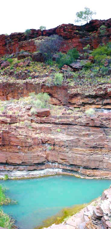
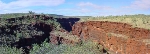
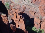
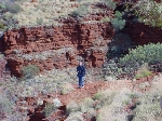
Dales Gorge.
Archaeological evidence shows that the Pilbara has been occupied for at least 30,000 years. Aboriginal culture, including its intricate social organisation and strong spiritual relationship with the land, is still strong today.
European ships visited the Pilbara coastline as early as 1618, but visitors like William Dampier reported an inhospitable coastline with a lack of water.
European settlement of the region did not begin until the 1860s, when the explorer Francis Gregory returned to the Swan colony with reports of abundant grazing land in the northwest. Shortly afterwards various European settlers, notably Walter Padbury, John Wellard and John and Emma Withnell, arrived with livestock and supplies to establish sheep stations on the De Gray River.
Pastoralism, with the help of free Aboriginal labour (?) , was to dominate the region’s economy for the next 100 years. To diversify, the early settlers began collecting pearl shell along the coastline.
This developed into a thriving industry centered on the port of Cossack. However, the Pilbara pearling industry was short lived and relocated to Broome in 1884. By this time, the growth of the wool industry and the establishment of other industries such as fishing, had firmly established the towns of Roebourne, Cossack, Point Samson, Port Hedland and Onslow.
A gold rush inspired by an opportunistic find by John Withnell also substantially increased the region’s population and saw the establishment of towns at Marble Bar and Nullagine. This activity had a dramatic impact on Aboriginal society. Enforced labour, introduced diseases and conflict displaced Aboriginal people from their country and claimed many lives.
Between 1946 and 1947 there was a widespread walk off by Aboriginal pastoral workers (still known as the pastoral strike) demanding better pay and conditions and access to their traditional lands. This movement led to the establishment of Aboriginal communities on a number of stations, notably Strelley and later Yandeyarra. It also brought the issue of Aboriginal rights into prominence and resulted in a social movement which used sophisticated methods to fight for this cause.
In the 1960s two dramatic events occurred which were to change the Pilbara forever. The first of these was the removal of Commonwealth restrictions on the export of iron ore in 1960 in response to a growth in world demand, particularly in Japan. The Pilbara had long been known to contain immense deposits, and a boom began which was to see the establishment of nine new towns in the region by 1970 (Dampier, Tom Price, Paraburdoo, South Hedland, Newman, Wickham, Pannawonica, Goldsworthy (now closed) and Shay Gap (now closed).
In the 1960s and 1970s, discoveries of oil and natural gas off the north west shelf were also made, and in the 70’s and 80’s the development of these resources expanded the region’s economy and population enormously.
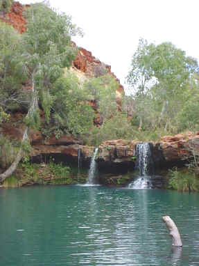
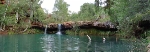
The extraordinary beauty of the Fern Pool near the Fortescue Falls
Beautiful bush near the Fortescue Falls
Taking advantage of a free day at West Angelas we decided to visit the Karijini National Park. After about one hour of travelling, half of it in dirt roads, we arrived at the visitors centre.
Karijini is the second largest national park in Pilbara covering more than 600,000 hectares and a modest $9 per vehicle per day is more than a fair price for such a good day.
Karijini is the name given to the Hamersley Ranges by the first inabitantes of the area, the Banyama, Yinhawangka and Kurrama people.
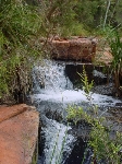
Evidence of their presence in the area goes back more than 20,000 years. Fern Pool and Circular Pool are special places for the Aborigines and places of rare and wild beauty.
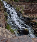
Karijini is situated just north of the Tropic of Capricorn in an area considered tropical semi-desert. Very high rainfall during the wet season causes spectacular views of the water falls in the gorges.
Karijini is located 110 km west of Tom Price and almost the same distance north of Newman. From Newman one follows the Northern Highway and turns to the Karinjini Drive. The roads are good but unsealed inside of the park area.
The area is subjected to cyclones during the cyclone season and the temperatures hover around the 40 degrees C. During the dry season the nights are cold and sometimes frosty.
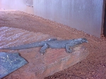
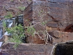
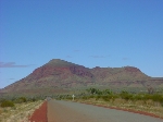
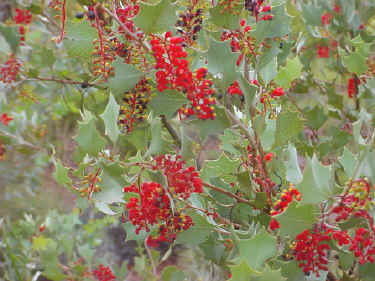
People guaranteed us that Karijini is too far south to have crocodiles and therefore one can enjoy a swim in the cristal clear waters of the numerous pools. The Pilbara region is known by its iron formations and Karijini is no exception. The land is red but the vegetation abundant and scenary suprisingly green.
The iron formation of the Hamersley Range originates more than 2,500 millions of years ago when the area was still cover by sea. With a sudden change of the sea level the strong currents generated cut through the rock forming the spectacular gorges and exposing the iron-rich banded iron formations
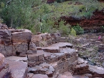
The series of gorges in the park plunges more than 100 metres deep and water run in the creeks most of the year. Camping and day trips are very popular and despite the winter starting to show its colours the park was busy with visitors.
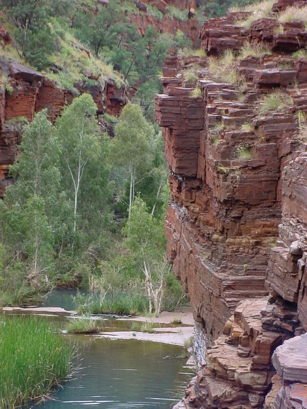
The Dales Gorge
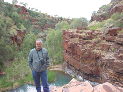
The Dales Gorge in the backgroud